


Our Vimeo Channel: The Goldseekers
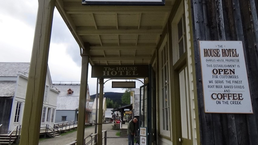
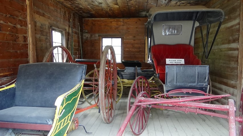
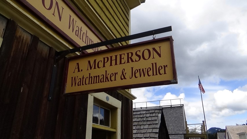
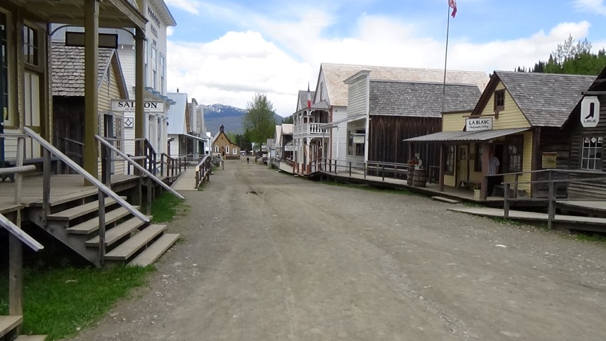
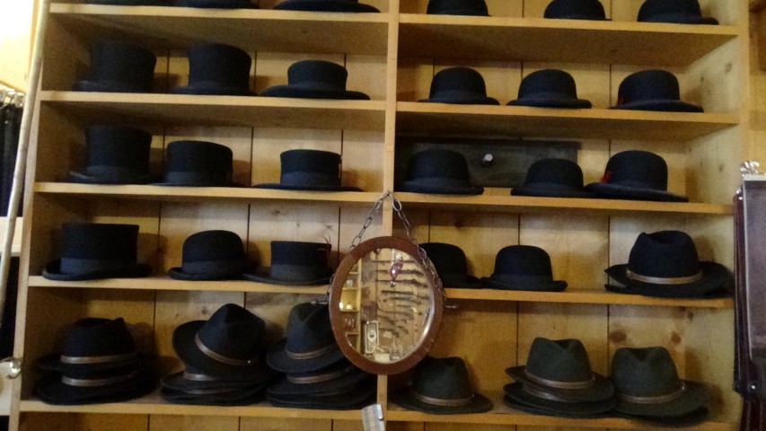
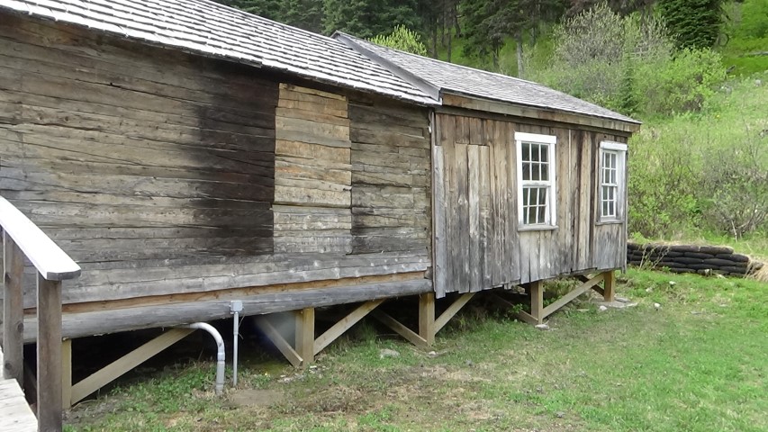
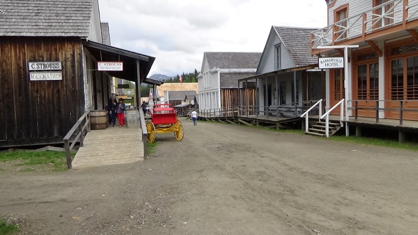
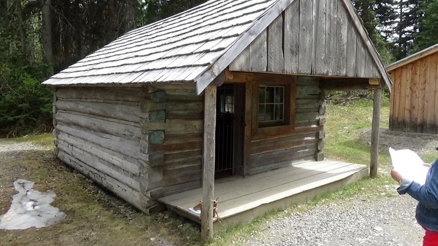
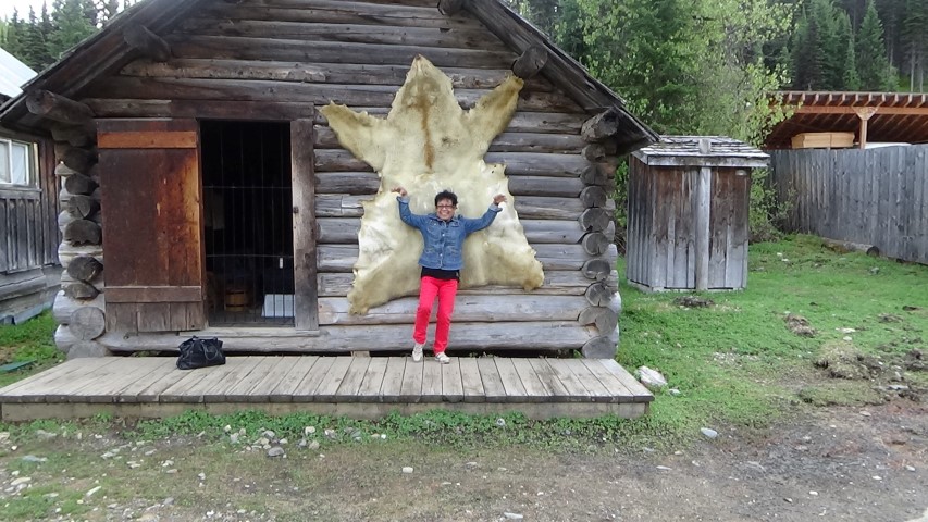
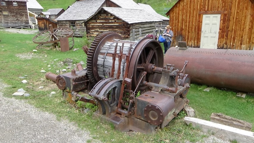
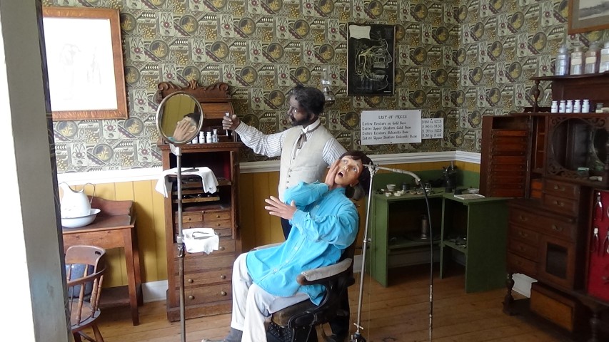
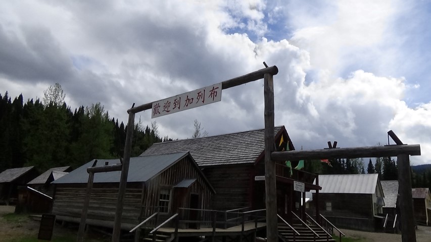
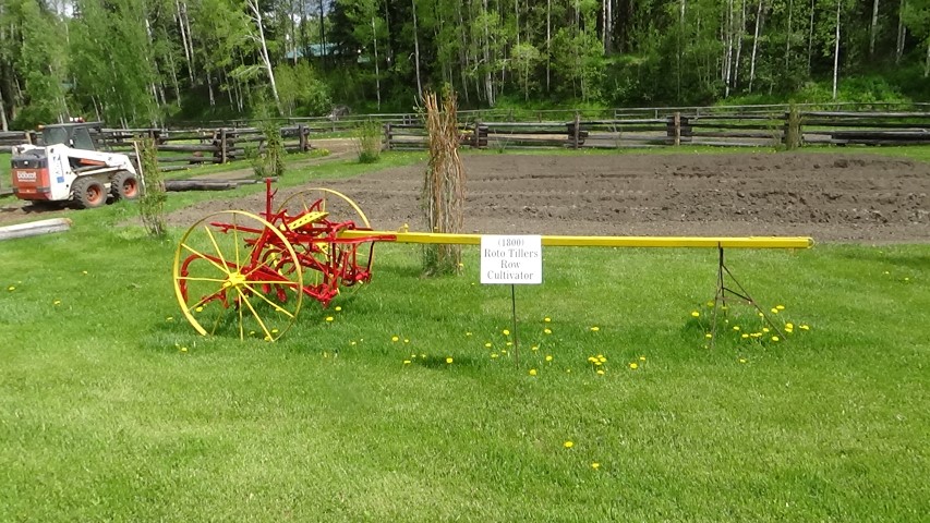
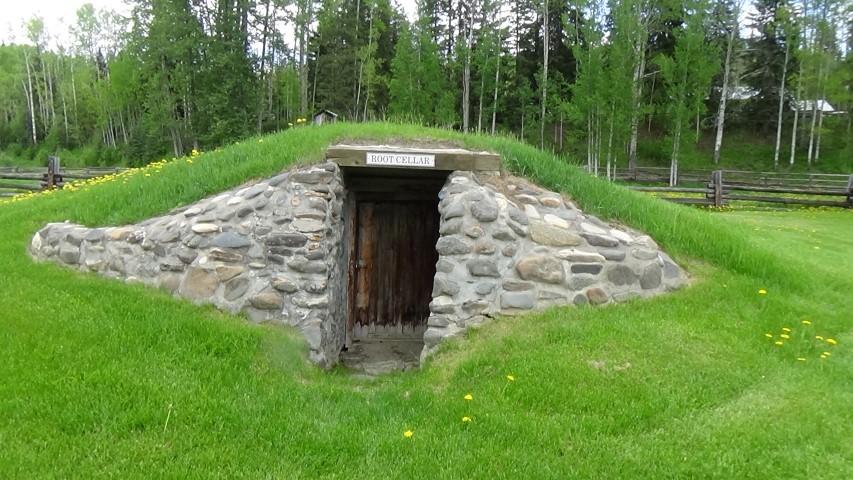
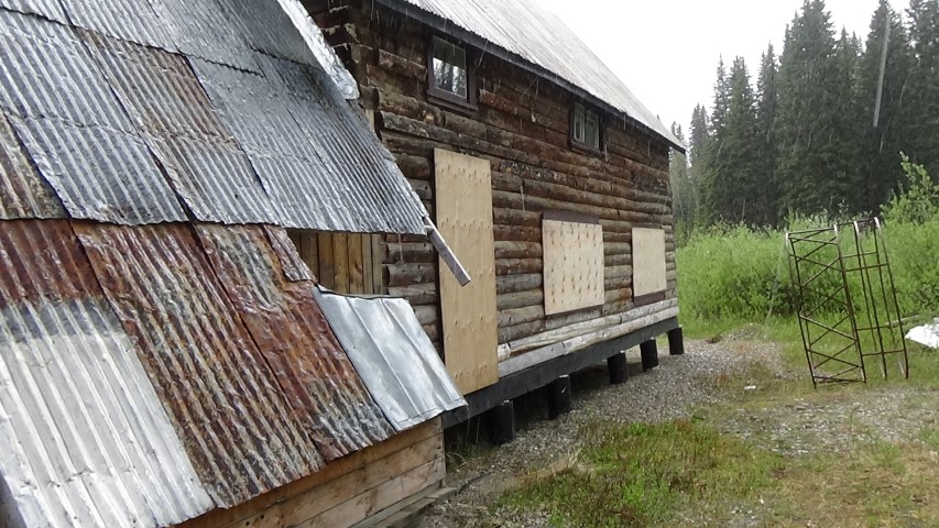
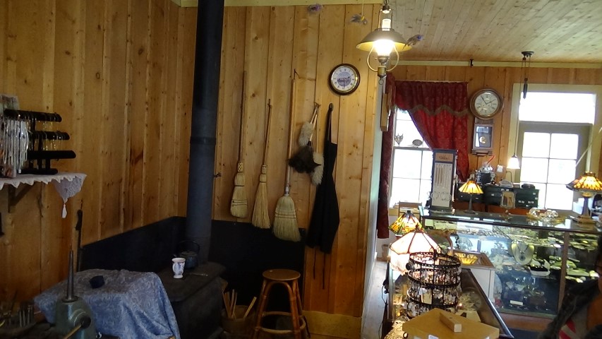
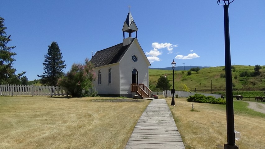
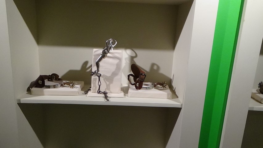
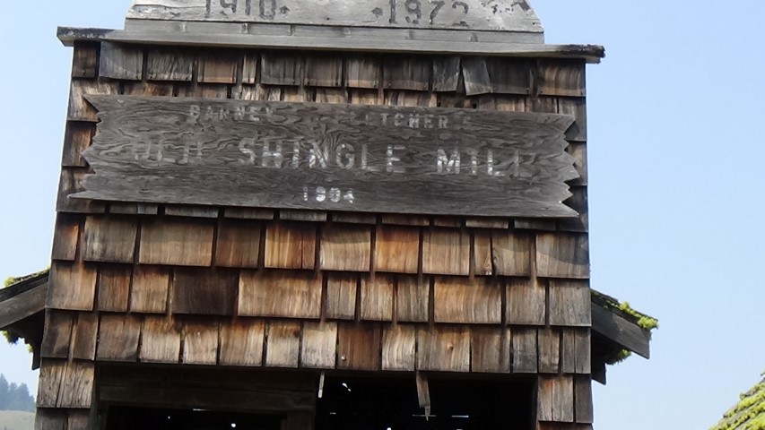
Barkerville is a preserved gold-rush town in the British Columbia interior. The Cariboo Gold Rush is demonstrated for visitors from all over the world. The historic town has a hundred original and twenty one reconstructed buildings, and a large collection of artifacts and documents. Barkerville was declared a historic site in 1923, and in 1958 British Columbia established it as a provincial heritage site. Barkerville was never really a Ghost Town since it had been occupied since its existence.
In 1858 the Frazer River Gold Rush drew thousands of people up the British Columbia river system in search of the "mother lode". It spread north from Rock Creek to Keithley Creek, Quesnelle Forks, and on to Richfield on Williams Creek. In 1861 a party led by William Deitz (Dutch Bill) found gold in a stream named Williams Creek. That same year the town of Richfield sprang up. In 1862 William (Billy) Barker staked a claim downstream from Richfield. By 1885 Barker recovered over $600,000 worth of gold (at about $18.00 a troy ounce). In total more than 5 million ounces of gold came out of the Caraiboo Goldfields.
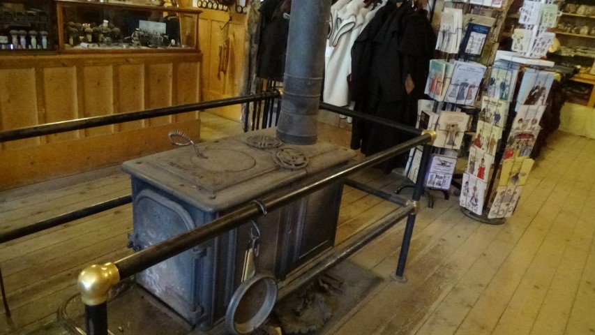
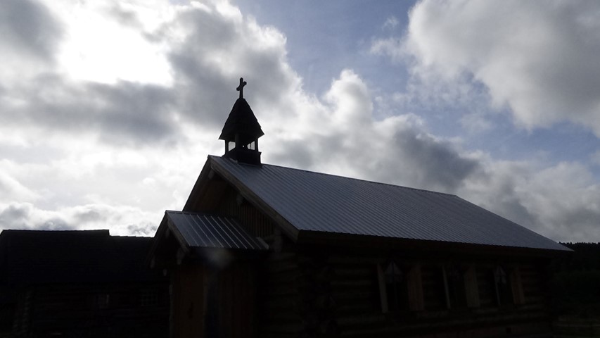
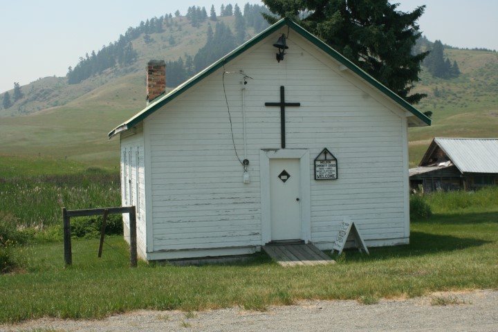
Barkerville sprang up around the time of Billy Barker's claim. At first there were makeshift log buildings and tents with false-fronted shanties along a narrow muddy street. It wasn't long before there were businesses of every kind: hotels, dance halls, saloons, stores, restaurants, billiard rooms, gambling houses, bowling alleys, a church, the Cambrian Hall, the Williams Creek Fire Brigade and many others along Williams Creek. On Sept 16th, 1868 Barkerville burnt to the ground, but was quickly rebuilt with a wider street. Gold seekers from all over the world came to Barkerville.
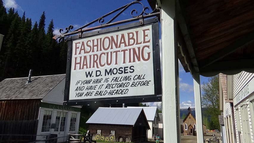
The initial miners came from California, but soon people came from eastern Canada. Chinese came from Guangdong. People also came from Mexico, Australia and Europe to Barkerville. By 1865 Barkerville was the largest city west of Chicago and north of San Francisco with more that 10,000 residences. A group of Dutch and German dancing girls, the "Hurdy Gurdies", came up to Barkerville from the dance halls of San Francisco. They were featured as the main attraction in a saloon where miners were charged one dollar to dance with them.
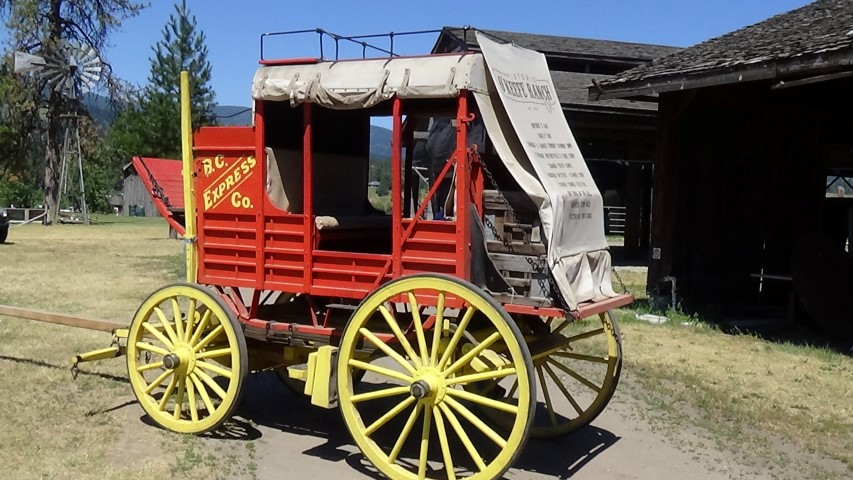
Food and supplies were hard to come by as there was no wagon trail to Barkerville. Supplies were carried on miners' backs or by back trains. It wasn't until 1865 that the Cariboo Wagon Trail was built from Yale to Barkerville. F.J. Barnard ran the BX Express (later called the BC Express) from Barkerville to Yale which usually took about four days to complete. Barkerville continued to be a thriving mining town until the 1930's when the new more modern mining town of Wells started to grow. The last full time resident of Barkerville died in 1979
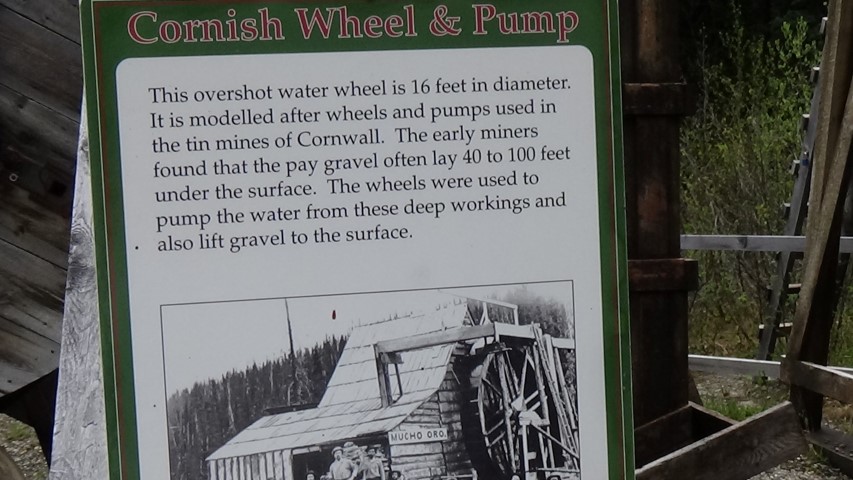
It is estimated that Williams Creek and two of its tributaries, Conklin and Stout's Gulch, produced $30,000,000 worth of gold between 1861 and 1898.
.
In 1858 the Frazer River Gold Rush drew thousands of people up the British Columbia river system in search of the "mother lode". It spread north from Rock Creek to Keithley Creek, Quesnelle Forks, and on to Richfield on Williams Creek. In 1861 a party led by William Deitz (Dutch Bill) found gold in a stream named Williams Creek. That same year the town of Richfield sprang up. In 1862 William (Billy) Barker staked a claim downstream from Richfield. By 1885 Barker recovered over $600,000 worth of gold (at about $18.00 a troy ounce). In total more than 5 million ounces of gold came out of the Caraiboo Goldfields.
Barkerville sprang up around the time of Billy Barker's claim. At first there were makeshift log buildings and tents with false-fronted shanties along a narrow muddy street. It wasn't long before there were businesses of every kind: hotels, dance halls, saloons, stores, restaurants, billiard rooms, gambling houses, bowling alleys, a church, the Cambrian Hall, the Williams Creek Fire Brigade and many others along Williams Creek. On Sept 16th, 1868 Barkerville burnt to the ground, but was quickly rebuilt with a wider street. Gold seekers from all over the world came to Barkerville.
The initial miners came from California, but soon people came from eastern Canada. Chinese came from Guangdong. People also came from Mexico, Australia and Europe to Barkerville. By 1865 Barkerville was the largest city west of Chicago and north of San Francisco with more that 10,000 residences. A group of Dutch and German dancing girls, the "Hurdy Gurdies", came up to Barkerville from the dance halls of San Francisco. They were featured as the main attraction in a saloon where miners were charged one dollar to dance with them.
Food and supplies were hard to come by as there was no wagon trail to Barkerville. Supplies were carried on miners' backs or by back trains. It wasn't until 1865 that the Cariboo Wagon Trail was built from Yale to Barkerville. F.J. Barnard ran the BX Express (later called the BC Express) from Barkerville to Yale which usually took about four days to complete. Barkerville continued to be a thriving mining town until the 1930's when the new more modern mining town of Wells started to grow. The last full time resident of Barkerville died in 1979
It is estimated that Williams Creek and two of its tributaries, Conklin and Stout's Gulch, produced $30,000,000 worth of gold between 1861 and 1898.
.
Barkerville
A video on Barkerville, 108 Mile Ranch and Cottonwood House

The first gold rush started in 1848 in California. But by the late 1850s the gold rush in California was pretty much over.
Where did the first gold come from in British Columbia has many stories, some say the First Nations traded gold around 1852 others say the Hudson Bay Company also traded gold around the same time.
British Columbia had three big gold rushes, one in 1858 on the Fraser River, one at Rock Creek in 1860 and another in 1862 in the Cariboo district. In each case thousands of men (and a few women) came from all over the world. First to Fort Victoria to get a miners license and also to purchase all the supplies they needed for the long trip (usually on foot or pack horses) to the goldfields. In early 1858 Fort Victoria only had a few hundred residences, but a few months later there were over 20,000 people and hundreds of tents scattered all over the landscape.
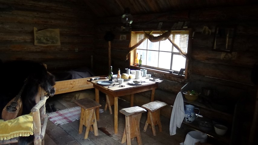
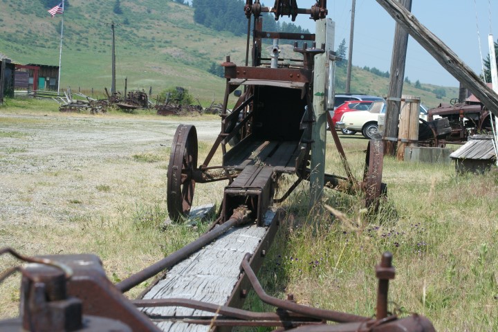
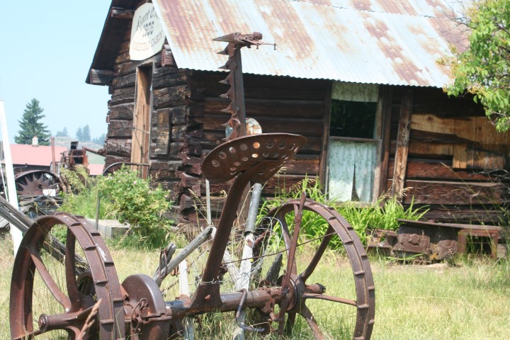
To live out in the wild woods you had to be prepared for anything and everything from rain to snow, from mosquitoes to bears. There was a lot of work to be done by the miners before they could begin to search for gold. They had to cut down trees, turn them in lumber to build mining equipment such as sluice boxes, rockers and flumes. They also had to build shacks, stake and register their claims. Most of the "Mining Towns" in the history of the gold rush days started out as a few shacks around the claim.
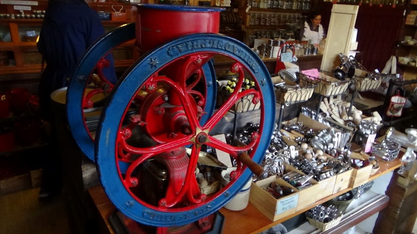
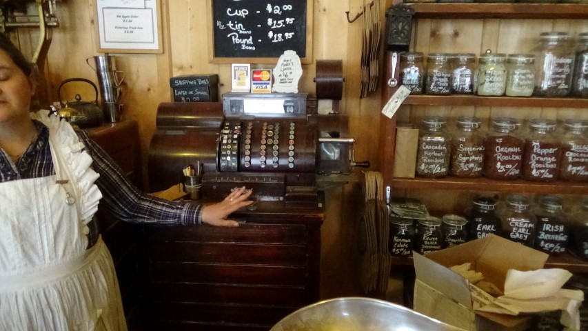
In the beginning there were no banks close to the goldfields so miners decided to either bury it in a safe hiding place or to carry it with them between the camp and their claims until it could be sold to the gold buyers. As more miners came to the goldfields they needed supplies and equipment and craved entertainment. The richest people in all the goldfields were not the miners but the business people who brought supplies to the miners. They provided an easy way for the miners to spend their wealth as fast, or even faster, than they could dig it up.
The Gold Rush in British Columbia
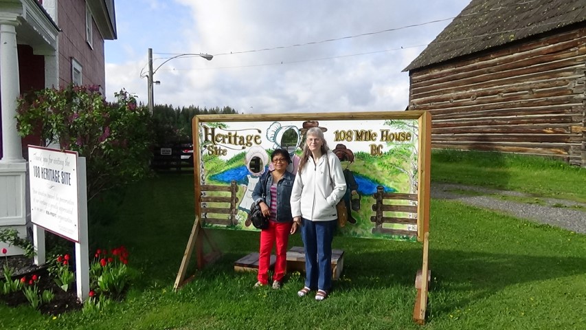
The 108 Mile Hotel as it was known then was built to serve the prospectors coming and going to the gold fields. Being close to 100 Mile House it was used more for lines of pack mules that carried supplies to the gold fields.
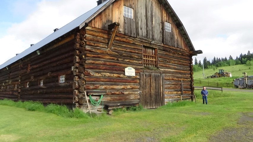
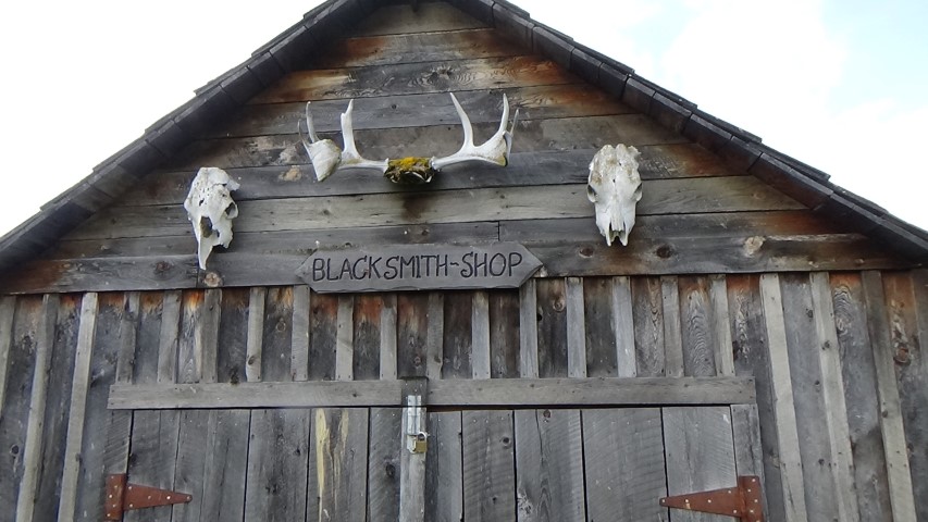
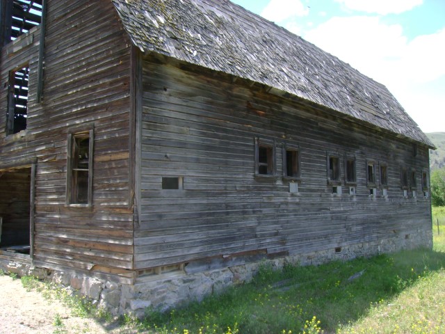
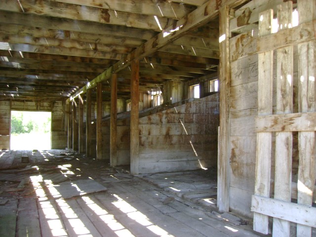
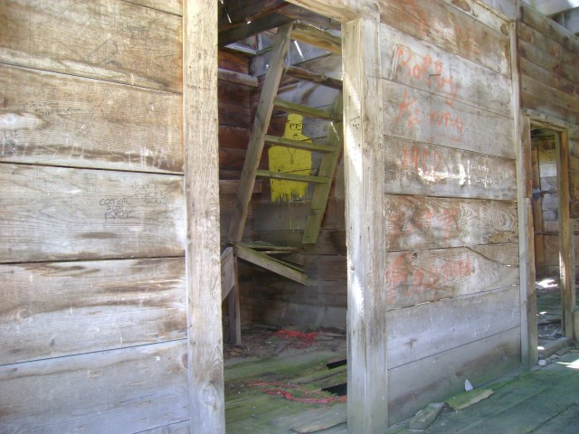
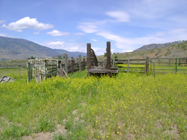
The beginning of 108 Mile House began in 1863 when William J. Roper built a Roadhouse on the 108 Historical Site beside the Cariboo Trail (Highway 97). In 1867 Roper built a log shed north of the road. From 1875-1885 the 108 Mile post, called the "108 Mile Hotel", was run by Mrs. & Mr. McVee. In 1880 William Walker pre-empted the 108 Mile Hotel and the 320 acres and built a log dairy ice house. He then tore down the log shed built by Roper and reassembled it on the current site as a store and telegraph office. Some say he was looking for gold buried by Agnus McVee. Walker also built a blacksmith shop, and, in 1891, he sold the 108 Mile House to Stephen Tingley for $320.00. Tingley built a framed blacksmith shop and a bunkhouse. In September of 1903 Tingley sold to Captain Geoffrey Watson. 1904 was the end of 108 Mile House as a roadhouse and stopping place. Watson turned the site into a ranch and built a large log Clydesdale Barn, the largest log barn in all of Canada. In 1915 Captain Watson was killed in WW1.
108 Mile Ranch
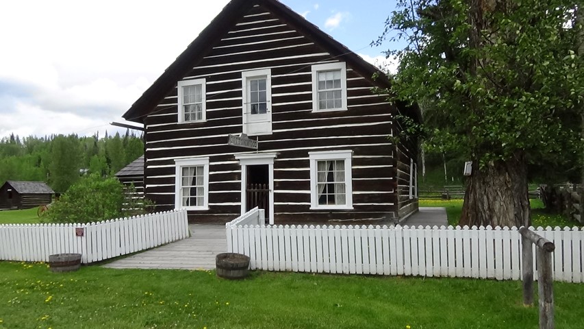
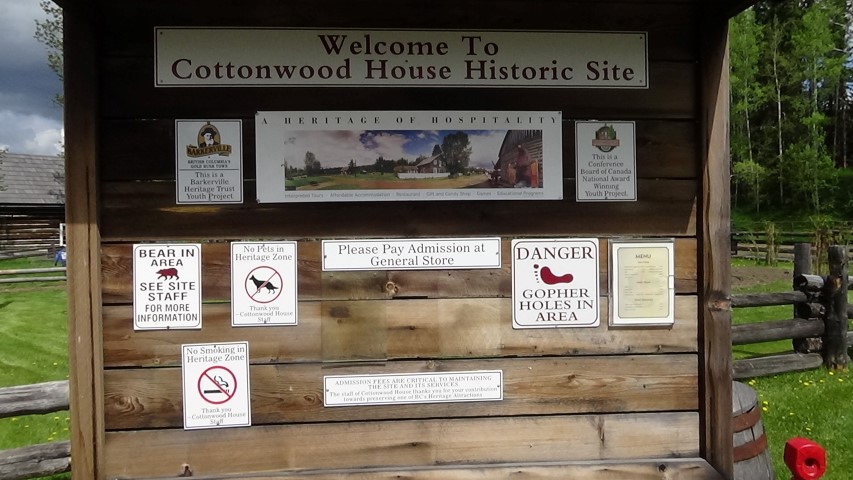
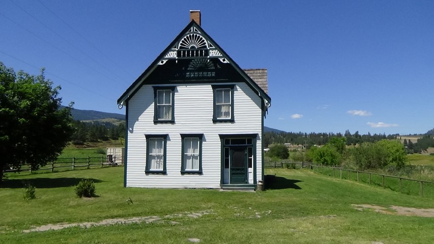
Cottonwood House was built on the Cariboo Trail between Quesnel and Barkerville. It was one day's travel from Quesnel, and overnight accommodations were provided at the House. John Boyd and his family acquired the property in 1874. With his wife Janet, ten children, and hired help they worked to raise crops, build barns, raise animals, and operate the House. They built a Post Office and a Telegraph Office. After John Boyd passed away in 1909 the House was operated by Janet and their sons William and Harry until 1951. Meals were served to the stage drivers and passengers as the horses were changed. The Cottonwood House earned a reputation as one of the finest stops on the Cariboo Trail. Today Cottonwood is a Historic Site and you can experience a sense of what it was like over 150 years ago.
Cottonwood House
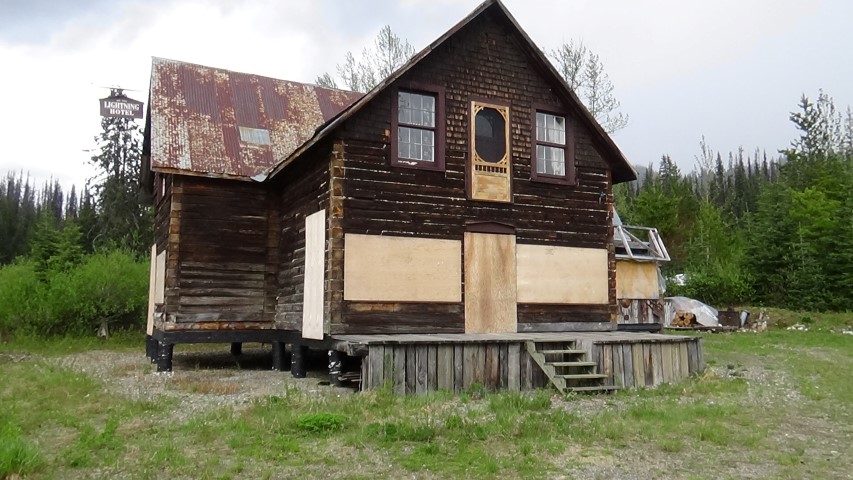
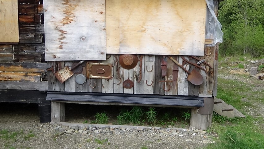
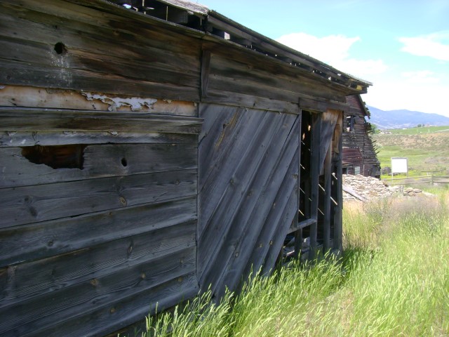
Ghost Town: Stanley
In 1863 there was another town being built called Stanley. There were 3 Hotels in Stanley, the Stanley Hotel, the Grand Hotel and the Lighting Hotel, along with many stores and businesses. There was also a dance hall, telegraph office, jail and the BX agency. Freight teams and the stagecoach on their way from Barkerville to Quesnel would stop in Stanley overnight to avoid travelling through Beaver Pass at night. At one point Stanley was bigger than Barkerville. The Lighting Hotel is the only building left in Stanley
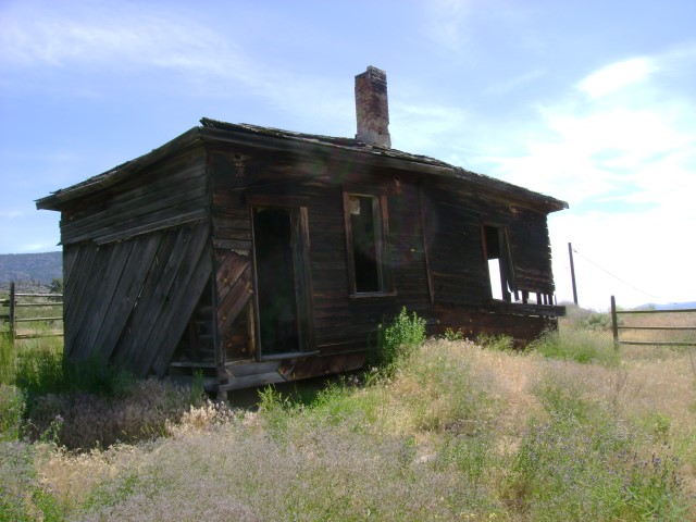
Ghost Town: Van Winkle
In the early 1860's a group of prospectors passed by a large creek during a thunder storm and they called it "Lightning Creek". Ned Campbell and his partners discovered gold near Lightning Creek. They staked a claim and began to sink a shaft to bedrock, but they had trouble with the "Cariboo Slum" (a fine silt that was gummy). Nevertheless they continued and by October they struck gold. In the first three days they recovered over 1700 ounces of gold. By this time there were hundreds of claims staked along the creek and its tributaries. In 1862 the town of Van Winkle soon sprang up, it was the first town on Lightning Creek. Van Winkle was a town of one street. On one side of the street there was the Government encampment consisting of several tents, and on the other side were the usual stores, restaurants and a bakery. Van Winkle died after the wagon trail was moved and the road to Barkerville bypassed Van Winkle and went through Stanley.
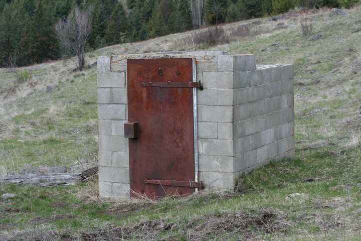
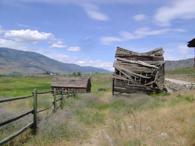
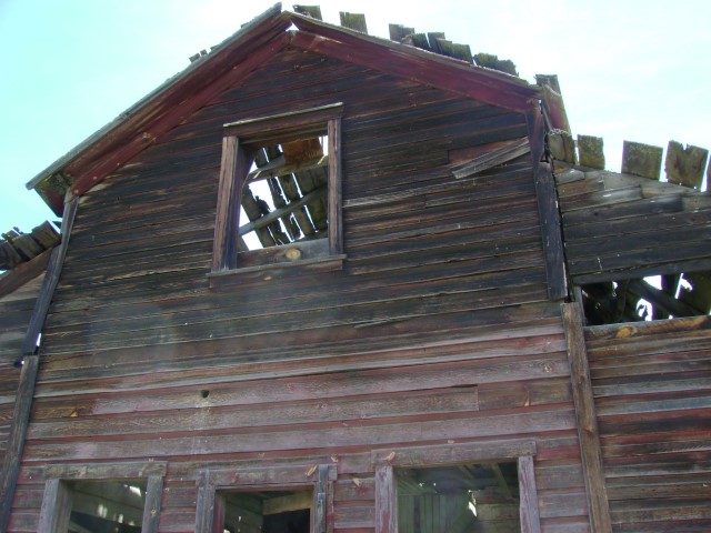
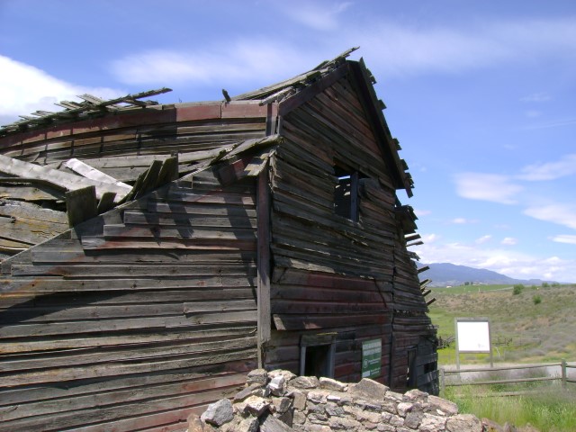
Ghost Town: Richfield
In 1861 gold was discovered near Williams Creek by miner Bill Cunningham. Soon the town grew as people came to try their hand at gold hunting. When the mines turned out to be the richest in the district, saloons, a church, the bank of British Columbia, the bank of British North America, hotels, restaurants and other stores were being built. In 1862 the deputy commissioner of lands named the town Richfield and it became the site of government buildings for the area with a courthouse, jail, post office, etc. There was also a slaughterhouse for all the cattle driven in for the hungry miners.
Gold was short lived in Richfield and soon all the miners moved to richer ground like Barkerville and the town followed. Today Richfield is a ghost town with nothing left but a few remnants.
Gold was short lived in Richfield and soon all the miners moved to richer ground like Barkerville and the town followed. Today Richfield is a ghost town with nothing left but a few remnants.
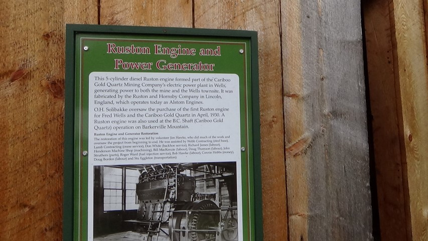
Wells
During the Cariboo Gold Rush of the 1860's Wells was just a campsite for prospectors. In 1927 Fred Wells (known as the Father of the Cariboo), a Field Engineer, founded the Cariboo Gold Quartz Mine. The little camp soon became a thriving company town and in 1934 the village was named after the founder of the Cariboo Gold Quartz Mine. The mine and the town grew into a more permanent population which replaced the tough gold digging fortune hunters from the hills and creeks of Barkerville and area. During its heyday of the 1930's Wells had a population of 4500 people more than Quesnel or Prince George. The mine continued to expand for the next 20 years until the early 1960's when the drop in the price of gold and rising costs eventually brought an end to the Cariboo Gold Quartz Mine. In 1967 the mine shut down permanently and most of the people moved away.
Today Wells is a thriving arts community and is divided by the highway into two sections. Buildings on the north side have been restored to showcase the art galleries. the theater, the general store, the museum, etc. On the south side there are restaurants, gas stations and accommodations.
John Carmichael Haynes came to British Columbia from Ireland in 1858. He hoped to join the police force which was to be established in BC. Haynes' first job was special constable to settle some disturbances among the gold miners at Hills Bar. Next he was to collect miners' licenses, but was not very successful. Haynes then served at Yale as a constable and in November, 1859, he was promoted to chief constable. The next year Mr. Haynes was sent to Rock Creek as gold commissioner and deputy collector of customs. Rock Creek was close to the international border and it was easy for Americans to gain access. At the same time Governor James Douglas ordered the Hope-Princeton trail to be built over the Cascade Mountains. In 1861 gold was discovered in the Cariboo which drew miners northward passing through the Okanagan Valley. Haynes was moved to Osoyoos Lake where he was responsible for the whole area of Rock Creek, Similkameen, and the Okanagan. Heavy movement of men and animals continued northward until 1864, when cattle ranches were established in the interior and began to supply food to the Cariboo District. In June of 1864 Haynes was transferred to Wild Horse Creek (Wild Horse River, BC) where a town had sprung up of a 1000 miners. Being mostly Americans lawlessness prevailed, but Haynes applied the colony's mining and revenue law. A few weeks later government officials visited the town and found everything to be in order. Haynes turned over 75 lbs of gold to the government, the revenue collected on imports. In recognition of his work, Governor Frederick Seymour appointed him a member of the Legislative Council. In 1865 Haynes obtained permission to reduce the size of the two large Indian Reserves at the head and foot of Okanagan Lake, making range land available for white settlers (wonder where the poor people had to move). In November of 1866, when the colonies of British Columbia and Vancouver Island united, Haynes remained on the civil list as deputy collector of customs for the southern boundary. Haynes remained at Wild Horse Creek as a magistrate and district court judge until 1872.
Mr.J.C. Haynes and his partner, Constable William Hamilton Lowe acquired 160 acres at the head of Osoyoos Lake in 1869 and the next year they added another 480 acres to their collection. Haynes absorbed all of the land in 1872 when Lowe suffered a severe accident. Between 1872 and 1874 Haynes increased his holdings to 20,756 acres. He first raised horses, but couldn't find a market. Then went into cattle increasing his heard to 4000 head. He made cattle drives over the Dewdney Trail to the Kootenays, Calgary Alberta, and over the Hope Trail to New Westminster. Haynes died on July 6th 1888. Thomas Ellis who held the mortgage foreclosed and obtained the ranch. J.C. Haynes' son Val took over as manager of the ranch which stretched from Osoyoos Lake all the way north to Oliver. When the South Okanagan Land Company bought out Ellis. Val remained as foreman. Later Val Haynes became the owner of part of the ranch located at the north end of Osoyoos Lake. The buildings shown here in the pictures were likely build by Val Haynes and include a house, barn and a bunkhouse.
Haynes Ranch
A video on the Haynes Ranch
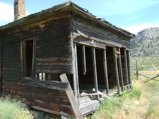
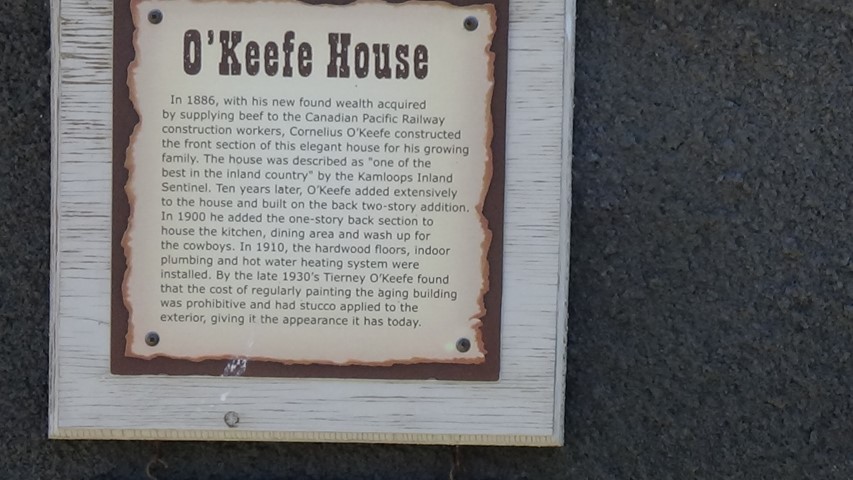
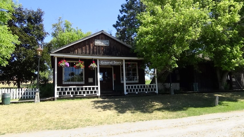
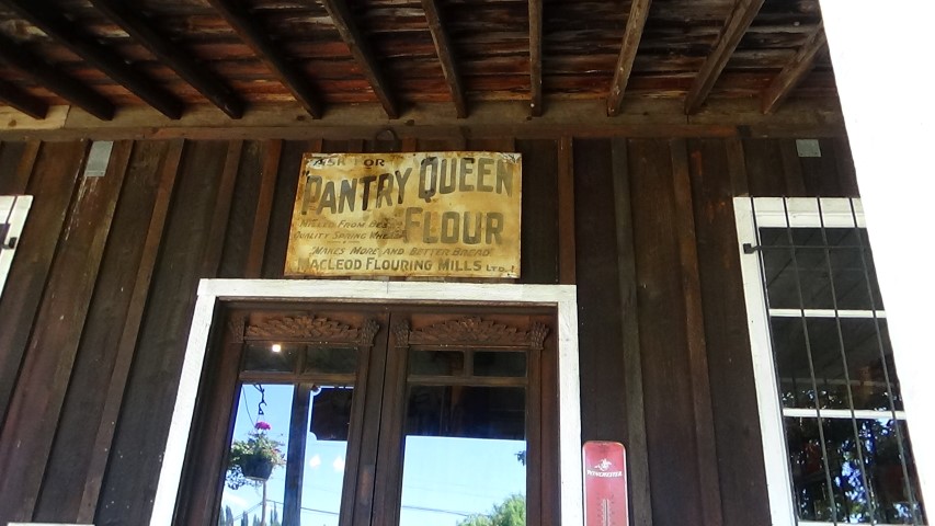
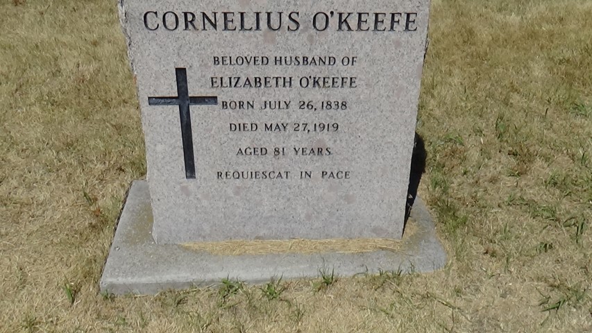
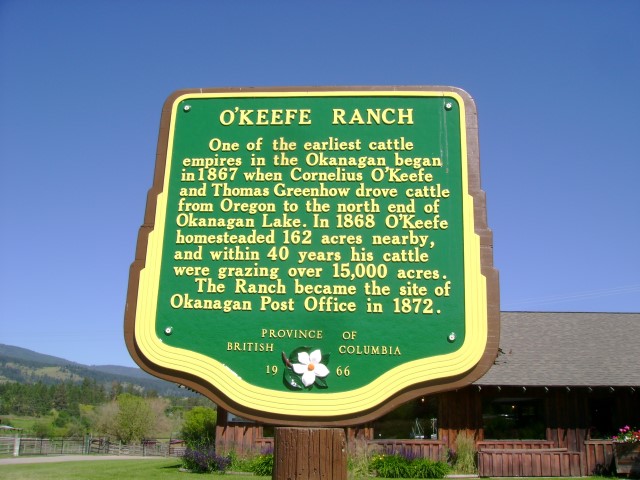
The Historic O'Keefe Ranch is two weeks older than Canada (June 15, 1867) O'Keefe's Ranch was founded by Cornelius O'Keefe (1838-1919) who was born in Ontario. Mr. O'Keefe came west to drive cattle from Oregon to the hungry miners in British Columbia. He then decided to raise cattle rather than drive them for such a long distance. By the early 1900's O'Keefe and his partner Thomas Greenhow had 15,000 acres. The O'Keefe Ranch was one of the earliest ranches in the Okanagan Valley. In 1872 it became the home of the first Post Office, the "Okanagon" Post Office. At the time the ranch was the end of the wagon road from Fort Kamloops. and became the stagecoach depot for the BC Express Lines. With a grist mill, post office, general store, and accommodations for people, the ranch became a center of community life for settlers in the area.
The Ranch operated for 100 years before it became a historical site by Tierney O'Keefe (1911-2000), the youngest son of Cornelius. The O'Keefe family operated the ranch as a tourist attraction until 1977. The land and buildings was then sold to the Devonian Foundation of Calgary, Alberta, which in turn gave the historic site to the City of Vernon. The ranch celebrated its 150th birthday this year (2017). There is lots to see and do at the ranch. They also have RV camping.
O'Keefe Ranch
A video on O'Keefe Ranch
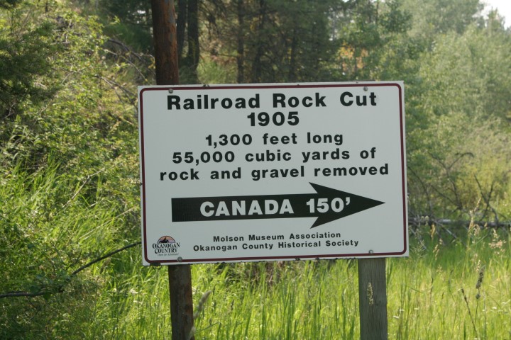
In 1862 John (Cariboo) Cameron, from Ontario, and six partners had a claim on Williams Creek near Richfield. John Cameron's wife died just a few days before he struck it rich. He promised that he would bring her body back to Ontario, but, before he fulfilled his promise, he wanted to work his claim as quickly as possible. So he hired 75 men to work around the clock. The men lived in a small group of cabins near the claim which they called Cameron's Town. As time went on the usual necessary shops like restaurants, hotels, saloons and stores were built. They also built a library which was funded by public subscription. The library opened in 1864 with John Bowron, the postmaster, being the first librarian. The name of the town was changed to Camerontown.
The town was short lived and in 1867 the library moved to Barkerville. By 1870 all of the town had moved to Barkerville.
After a funeral attended by all 90 miners who were wintering in the Cariboo,
Sophia Cameron was placed in a tin casket and temporarily buried under a deserted cabin.
In late January of 1863 Cameron disinterred the coffin and, with some helpers headed for Victoria with the coffin and fifty pounds of gold. They traveled by snowshoes, by horse, and by steamer for 600 miles and by March 7th they reached Victoria. Cameron then had the coffin filled with alcohol to preserve his wife's body. He then arranged a second funeral, buried her in Victoria and headed back to the Cariboo to work his claim. In November of the same year he disinterred the coffin the second time and headed for Ontario. Cameron arrived in Ontario and buried his wife for the third and final time just after Christmas. End of story right? No! Roomers spread that the coffin did not hold Sophia Cameron, that it held gold instead. John Cameron had the coffin raised again and opened. When they opened the coffin the alcohol spilled out and her family recognized Sophia. She was finally buried for the last time to rest in peace.
Ghost Town: Camerontown
Molson was founded in 1900 by promoter George B. Meacham, and investor John W. Molson. The same Molson from the Molson Brewing Company and the Molson Bank which had branches in every province in Canada. In the first year the town had a newspaper, an attorney, three general stores, a drug store with a doctor's office, a blacksmith shop, a dance hall, three saloons, a livery barn, an assay office, and a three story hotel complete with a two story outhouse ( I wonder how that worked!). The Hotel was called Tonasket, named after the Okanogan Indian Chief. At a cost of $8,500, it was one of the finest hotels in the country. It had 35 rooms, the rates were from 50 cents to $1.00 per night and meals were 35 cents. The population grew to three hundred the first year, but by June of 1901 the population was down to 12, as mining didn't amount to much in the Okanogan Highlands. The Buckeye Mine built a twenty stamp mill in 1904 but only lasted for a couple of years. The Poland China Mine had an eight stamp mill and operated for about forty years off and on. Some ore from this mine was shipped to the Trail Smelter in British Columbia. This was the only ore shipped from the Molson area and it closed down in 1938.
The Great Northern Railroad completed its route to Molson in 1905-06, a stopover from Spokane to Princeton, BC. This brought more life to Molson and the town began to prosper again. Meacham never did register the land on which the town stood, so a local man by the name of MacDonald registered the land and informed the residences and businesses that they were trespassing and ordered them to move.
A new Molson was established about half a mile north of the old town site. For the next 20 years a bitter feud commenced over which was the official town. The bank was built on skids so it could be moved from one place to another. The Post Office was stolen and moved while the Postmaster was away for lunch.
In 1935 the GN stopped its route to Molson and, once again, many people left to work elsewhere and only a few ranchers and farmers remained. That's how you will find Molson today.
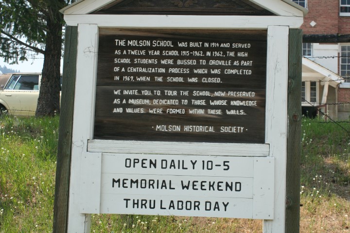
Old Molson has many old buildings and a great display of old machinery. The Old School House is a museum and is a must see.
Ghost Town: Molson Wa.

Here is a video on Molson
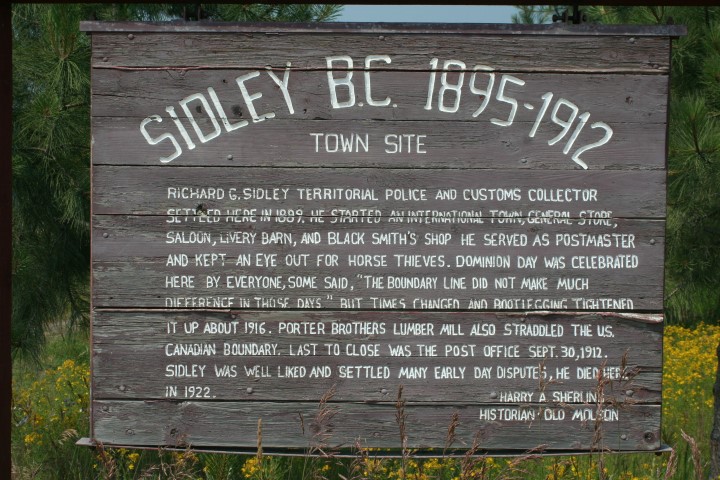
Most of the settlers in the Sidley area were farmers. Mining camps like Camp McKinney sprang up not far from Sidley so there was a good market for all kinds of produce. The little town of Sidley was named after Richard G. Sidley who arrived in 1885 from Ontario. Mr. Sidley started a saloon, general store, the international hotel, livery barn, customs office and a blacksmith shop. Sidley was appointed the first postmaster in 1895. He was also made Justice of the Peace and Customs Officer. Sidley was often called an anarchist, thus the area became "Anarchist Mountain". Before Sidley this area was called "Larch Tree Hill". The Great Northern Railway had a station in Sidley and passenger service. In those days, when there weren't any roads to speak off, a ride on a train was so smooth and comfortable compared to the rough trails, so a train station in any community was welcome. The first school in Sidley was held on the Cross Ranch in an old log cabin around 1899. In 1900 a framed school house was built. Children from Molson came to Sidley since there was no school in Molson. The Post Office was the last business to close in 1912.
The Porter Brothers owned about 20,000 acres of land and raised horses and used them for logging. They also owned a sawmill near the border where the VV&E (Great Northern) ran. There was a duty on dressed lumber, so they cut the lumber on the Canadian side, ran a conveyer belt across the railway tracks to their planner mill on the American side planned the lumber there and shipped it to Spokane where it brought high prices.
When the Dewdney Trail was built from Hope to Rock Creek, it wound around the south side of Anarchist Mountain, sometimes on the American side and sometimes on the Canadian side. The Chinese prospectors used this trail to bring their supplies to the Rock Creek gold rush. At one point, on the American side, they had all their supplies taken away from them by the Americans. They then built a new trail over the Mountain on the Canadian side. This trail was known as The China Trail.
Ghost Town: Sidley
Canada US border near Sidley
A video on Sidley
Miette Hot Springs near Jasper Alta.
In the 1800's the Native Indians used the hot springs for physical and spiritual well-being. They introduced the hot springs to members of the Hudson Bay and North West Companies Around 1910 a crude trail was built to the hot springs and in 1913 a small log bathhouse was built. In 1919 striking coal miners from the nearby community of Pocahontas, built a temporary bathhouse and two sweat houses. As time went on Jasper National Park became more popular which prompted the construction of a proper road and a permanent aqua court. It was built as a unemployment relief project and was completed in 1938. In 1986 construction of a new facility was built about one half a mile from the original bathhouse. The ruins of the original bathhouse still stand and anyone can walk up to see where the hot springs come out of the ground.
The mineral water which is rich in sulfate, calcium, and potassium is heated by the earth and comes up to the surface at an average temperature of 129 F. The water is tested and chlorine is added as part of health regulations ("chlorine" and "health" should not be used together!), then the water is cooled to a temperature between 98 F and 104 F.
Here is a video on Miette Hot Springs
Our U Tube Channel: TheGoldseekers